Magpie Robin Bangladesh has built enduring client relationships based on consistent quality service. Over the year, it is growing as a progressive leader through hard work and strategically selected consulting wings that together bring multi-dimension of experience. Each wing has capabilities and success in delivering consulting solutions
Aerial imagery takes flight, capturing landscapes from a bird's-eye view. Photos are snapped from planes, helicopters, or even drones, offering a unique perspective for maps, urban planning, and environmental monitoring. High-resolution images reveal intricate details invisible on the ground, while historical aerial photos track changes over time.
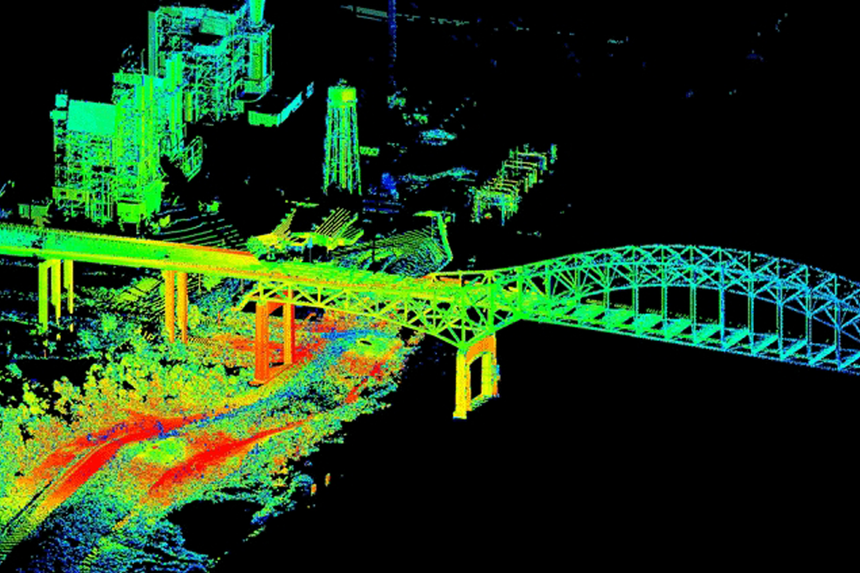
Aerial triangulation (AT) is an integral part, prior to producing any photogrammetric products from Stereo images. It is a mathematical process to determine the position and orientation parameters (Exterior orientation) of the photographs at the time of exposure that is eventually used for orthophoto generation, at mapping and height model generation. AT is a critical step related to the project's quality, and can be represented as the heart of all photogrammetric processes as the quality of the exterior orientation parameters and the scale of the photographs are the determining factors in the quality of the mapping products.
A topographic survey meticulously maps the terrain's features, including elevation, contours, and landmarks. Surveyors use specialized equipment to collect precise data points across the landscape. This information is crucial for urban planning, engineering design, and construction projects, providing insights into the terrain's characteristics and aiding decision-making. Topographic surveys are essential for assessing land suitability, managing natural resources, and ensuring safe and efficient development of infrastructure.
Orthophotos are aerial images corrected to remove distortion caused by terrain relief and camera angle. They offer accurate representations of the Earth's surface, suitable for mapping and analysis.
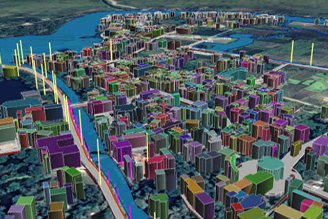
Urban planning is a technical and political process concerned with the development and design of land use and the built environment, including air, water, and the infrastructure passing into and out of urban areas,
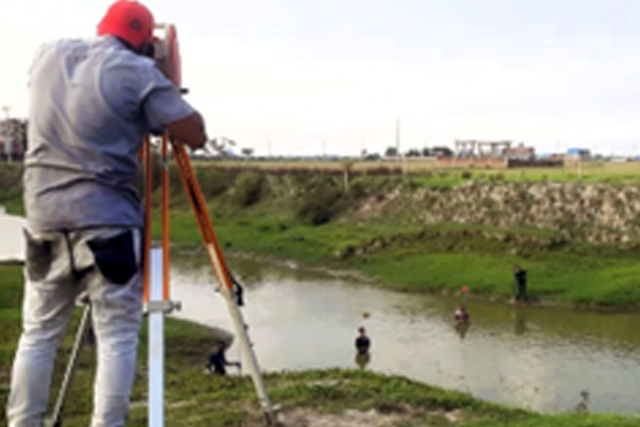
A topographic survey meticulously maps the terrain's features, including elevation, contours, and landmarks. Surveyors use specialized equipment to collect precise data points across the landscape.
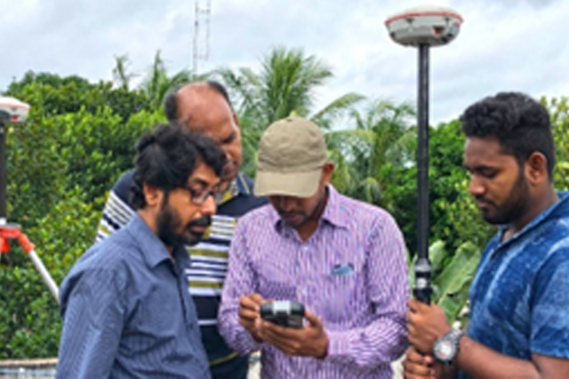
A total station is an electronic/optical instrument used in modern surveying and building construction. The total station is an electronic theodolite (transit) integrated with an electronic
Photogrammetry is the science of obtaining accurate measurements and 3D information from photographs. It converts aerial or ground images into detailed maps and realistic 3D models, helping surveyors, engineers, and planners analyze the earth’s surface with precision. This modern technique transforms simple images into valuable geospatial data used for mapping, design, and visualization.

| Consultancy Services for conducting feasibility study for Maheshkhali/Matarbari-Bakhrabad 3rd Parallel Gas transmission pipeline project | ||
| Client | Start Date | End Date |
|---|---|---|
| KBR & IIFC | May 2024 | On Going |
| Feasibility study and detailed design for construction of Gobra-Bagerhat-Pirojpur railway | ||
| Client | Start Date | End Date |
|---|---|---|
| BR & IIFC | June 2020 | December 2020 |
| Digitalization of Islands along Bay of Bengal, Haor and Beel Areas | ||
| Client | Start Date | End Date |
|---|---|---|
| MoICT & IIFC | March 2020 | August 2020 |
| Topographic & Inventory Survey of 23 No of textile mills of Bangladesh Textile Mills Corporation | ||
| Client | Start Date | End Date |
|---|---|---|
| MoICT & IIFC | March 2020 | August 2020 |
| Topographic Survey, Physical Feature Survey and GIS Database Preparation for Gaibandha Strategic Development Plan | ||
| Client | Start Date | End Date |
|---|---|---|
| Urban Development Directorate (UDD) & BRAC | September 2019 | January 2020 |
| Topographic Survey of Primary School Area Using Drone and Photogrammetry Technology | ||
| Client | Start Date | End Date |
|---|---|---|
| LGED | May 2019 | June 2021 |
Since its establishment, MAGPIE ROBIN aim is to be known as a multidisciplinary consulting firm with the ability to complete projects successfully in various fields of consulting services in which we specialize. The central functions are managed through a number of units, including Physical Planning, Human Resource Development, Research & Development, Quality & System Management, GIS in Geospatial & Geotechnical arena, Information Technology (IT), Quantitative and qualitative surveying.